|
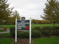
The Washington (now Robbinsville) to
Walnford Trail, being contemplated, would run from the Washington
Township Community Park (Mercer County), across the NJ Turnpike on
Gordon Road, then run southerly behind the Matrix warehouse complex
leading to the Indian Run. This section of the trail would run
through old-growth forest lands, and the non-descript rear of the
Matrix warehouse complex would be completely shielded from view.
The Indian Run flows under I-195. However, trail traffic would
need to move parallel to the roadway in a northwesterly direction to
Manor Drive. It would then have to cross CR-526 in order to
continue the trail on the southerly side of I-195 and parallel to
CR-526 leading toward Allentown Borough (Monmouth County) at the
municipal boundary. At this point, the Indian Run creek runs
under CR-526 (Church Street), continues behind the Allentown Borough
Water Company and continues its meander to and through Allentown
Borough's Heritage Park. Here, the Indian Run joins the Doctors
Creek.
The trail would continue as part of the Heritage Park's trail loop
system. It is expected that a connector trail will extend to the
new Upper Freehold Regional School District's middle school --
affording a walking route for students from both Allentown Borough and
Upper Freehold Township -- and exit toward Breza Road in Upper Freehold
Township. It would then continue on the
local streets (Breza Road and New Road) to connect to the Harbourt
Soccer Fields, then crossing S. Main Street, the trail continues on
Ellisdale Road to the entrance to the Byron Johnson Recreation
Facility. There, the trail would connect to the existing trail
and
loop system.
The Upper Freehold Regional School campus is adjacent to the Byron
Johnson Facility. The school campus would benefit
from a continuous trail system so that students can become walkers
instead of bus riders in order to get to the several school
buildings. As well, there are opportunities for science /
environmental studies, historical studies, and physical education and
cross-country training -- all benefits that come with such a
trail system.
From the
school campus and Byron Johnson Park, the trail would proceed southerly along
Ellisdale Road to Polhemustown Road (running essentially parallel to
the Crosswicks Creek) and then easterly along Polhemustown Road to
Walnford Road. The southern terminus of the trail would be at the
back entrance to Historic Walnford Park.
|